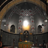
The eastern part of Epping Forest District isn't very near Epping and there's not a lot of forest either. Just lots of small villages and one small town, Ongar, and plenty of fields. However hidden away is one of gems of Essex, St Andrews Church at Greensted. It is the only remaining log church in England, built in the reign of King Canute and nearly a thousand years old. The typically Essex tower is a much later edition but the whole church is magical, one of my favorites. My walk didn't take me past this church but the Essex Way goes right past the front door.
 On the route was Stapleford Airfield which has an interesting history. Amy Johnson flew from here in the thirties; the original airline got in to financial difficulties and the new owner moved operations to Heston and the rest is history; during the war the RAF took over and the airfield was used to fly SOE agents into Europe; in 1945 a hanger was hit by a V2 rocket killing seventeen people, many of whom are buried in North Weald cemetary. In 1987 I flew from this airfield on a thirty minute flight and got to take the controls for a few minutes, scary but fun.
 Walk 5 took me from Stapleford Abbots via Lambourne to Cabin Hill in Hainault Forest, where the Essex border meets the borders of Havering and Redbridge. It was a very chilly morning which blossomed into a fantastic autumn day with warm sunshine and cloudless skies. It was a very pleasant walk entirely along footpaths and bridleways, only crossing two roads on the way. The first part was gently uphill to a ridge with great views west towards London. I spotted the aerials at Crystal Palace with the bins.
 The first rest stop was at St Mary's church about a mile north of Stapleford Abbotts. I was quite surprised to meet to meet the old lady who had waited at the bus stop with me. Her name was Jean and she was the church sexton (unpaid verger) and invited me in for a cup of tea. After crossing some very wet grassy fields I climbed rather nervously over a stile into a field of cows, who were even more nervous and stampeded into the distance. The footpath went along the southern boundary of the airfield but there was no actual fence, the end of the runway was about fifty metres away and the landing planes flew right over my head.
 The next rest stop was at Lambourne Church, whitewashed with typical Essex broach spire, but unfortunately this church was locked. This was a shame as it has some interesting memorials; one is to a bomb disposal officer called in to deal with two unexploded bombs left by the Germans in 1940. After dealing with first one, the officer went for tea at the Hall but was killed defusing the second bomb.
 From Lambourne, I followed the Three Forests Way to Hainault Forest, the only bit of forest on the walk so far. Hainault, like Epping, is a shadow of its former self, it once stretched to Leytonstone. It was rescued from developers in 1906 (thank you). The country park is in Redbridge, the golf course is in Havering and the forest is in Essex. There are some fine views of central London, the Telecom Tower and London Eye clearly visible, and St Paul's Cathedral, allegedly. A really enjoyable 6 miles.
CLICK ON THE PICTURE BELOW TO SEE MORE PICTURES