Showing posts with label Essex coast. Show all posts

Sunday, 26 September 2010

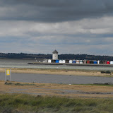
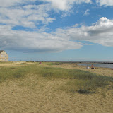
Walked the Essex Coast!

Well I did it!

455 miles, 52 days (26 in Archie), averaging 8.9 miles a day.
Six estuaries (Thames, Roach, Crouch, Blackwater, Colne and Stour), four islands (Canvey, Wallasea, Mersea and Two Tree) and one Sea (North).

I started on gloomy, mild January day at Purfleet and finished on gloomy, mild September day in Manningtree and I couldn't have done it without the help and support of Archie, C2C trains, the Essex bus timetable and my feet. I celebrated by having a superb tea at the Quay tea rooms in Mistley.

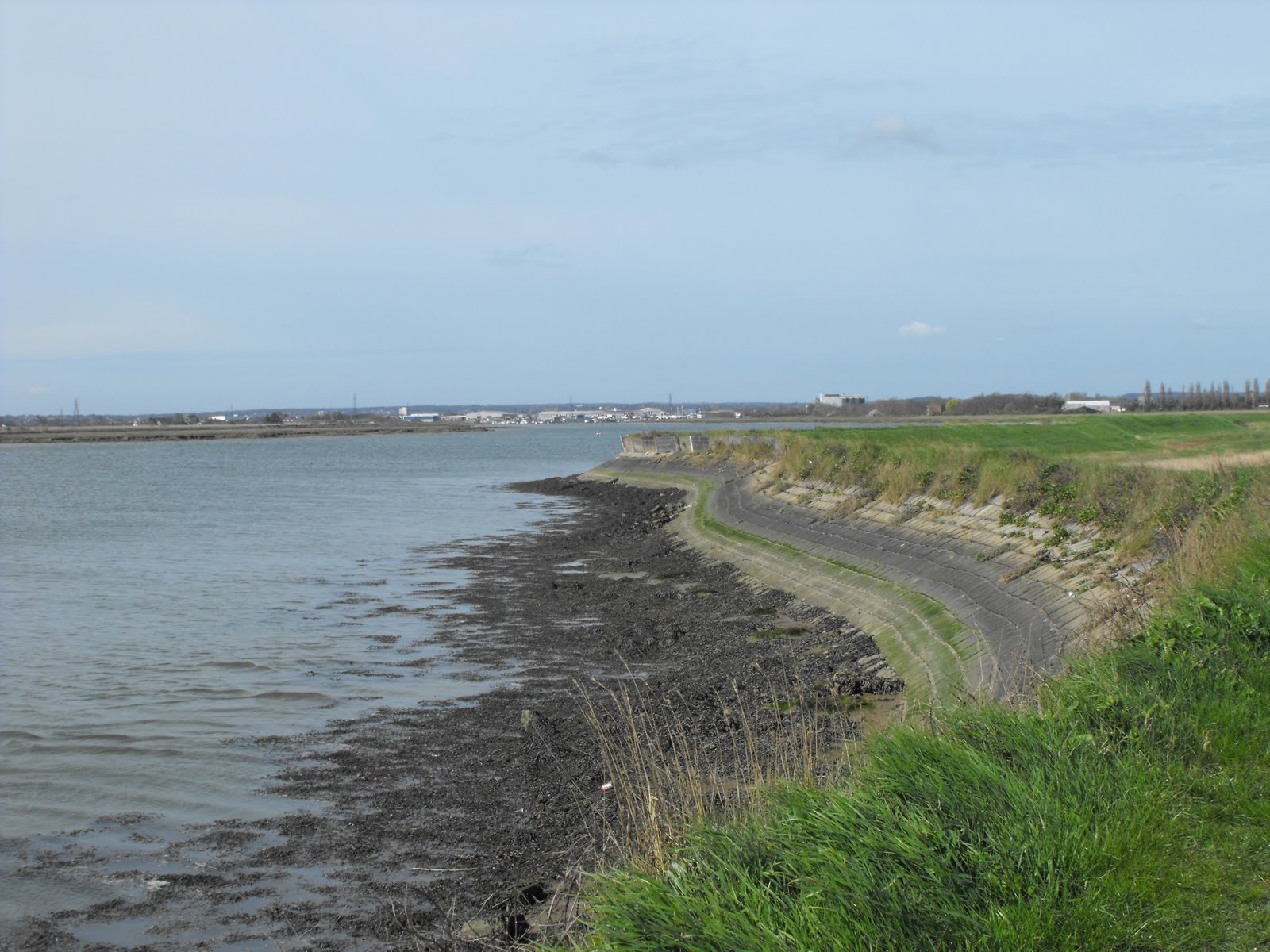
I passed through nine of the fourteen district of Essex, (Basildon, Castle Point, Chelmsford, Colchester, Maldon, Rochford, Southend-on-Sea, Tendring, Thurrock), points going to Basildon with coastline on the Thames and Crouch estuaries. Amazingly most of the 350 miles of coastline is easily accessible by footpath, the exceptions being Foulness, (owned by the MOD), a large area south of Colchester between the Blackwater and the Colne (also owned by the MOD) and the western edge of Hamford Water (chemical and explosive factory). Several parts of the Thames Estuary coastline used for landfill will be transformed into nature reserves in the near future. Particularly exciting is the news that the Essex Wildlife Trust has purchased Mucking flats.

With all that walking I had plenty of time to think. Here are some of my thoughts; there are 1.7 million people in Essex and there is a boat and static caravan for each of us; Essex is a very beautiful county; Jaywick is one of the ugliest places I ever visited; birdwatching is interesting if you take a friend with to you to identify the birds. knots put on a great flying display; National Express East Anglian timetables are not be trusted and you can go off sea wall after a while.

However this trip was not without it problems. I've lost a GPS, broke a camera, blew up the hob cover in the van and wore out a pair of boots.

The best bit about this walk was the solitude and the peacefulness of the coast, mostly the only sounds were the wind, bird calls and water lapping on the shore. Meeting the couple who were walking around Britain warns me that coast walking can become addictive and if I had a spare year and half I would definitely continue.

Was it worth? Absolutely!

Photo albums
Thames Estuary
Roach and South Crouch
North Crouch
The Dengie
Blackwater Estuary
Mersea Island
Colne Estuary
Sunshine Coach and The Stour

The Sunshine Coast

The last part of the walk was along the Sunshine coast of Essex, from Sandy Point (which was stony) north to Stone Point (which was sandy). The high point of the walk was the Naze Tower and its views, particularly of the Suffolk coast, acting like a siren, tempting me to continue. The very last part of the walk was along the Stour estuary, past some very grand buildings on the other shore, ending at a sluice and the Suffolk border.


Click on the picture to open the album.

Wednesday, 22 September 2010

Strolling along the Colne

The Colne is one of the shorter estuaries and certainly the narrowest, which gives good views of the opposite bank. Most of the western bank is inaccessable to anyone not in the military, so this walk started in Fingrinhoe, then north through Rowhedge to Hythe in Colchester where the tidal range ends. The walk along the eastern bank from Hythe to Brightlingsea is one of the best in Essex, taking you past the University of Essex campus, the delightful village of Wivenhoe and along a disused railway line to Alresford Creek. Wivenhoe was once an active port when very large ships towered over the nearby houses.

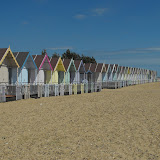
At the end of the Colne is Brightlingsea, a historic Cinque port, infamous in the 1990's for the live export of animals, prompting protests by local people and over-zealous policing/police brutality. Today, it has a huge marina and some posh development on the quayside. It is a rather quaint holiday destination, with colourful beach huts and an outdoor swimming pool. I had a very nice tea there with my friends.

Not really on the coast is St Osyth, a little town full of listed buildings. The cream of the crop is the Priory Gatehouse. The Priory itself is owned by developers and is up for sale, much to the dismay of the local residents. It's well worth a visit and has a couple of fine tea shops.


Click on the picture to open the album.

Monday, 13 September 2010

A bit more coast

Here are some views of a sunny Sunday and a less sunny Monday yomping around the coast. Not far to go now


Just click on the picture to open the album

Sunday, 1 August 2010

Blackwater Estuary

Views from my very enjoyable, week-long, seventy mile hike around the Blackwater Estuary, which at times, looked and felt like the Med.


CLICK ON THE PICTURE TO OPEN THE ALBUM

Sunday, 18 July 2010

Mersea Island

Circumnavigate sunny Mersea Island!


CLICK ON THE PICTURE TO OPEN THE ALBUM

Monday, 5 July 2010

The Dengie

Some pictures from my epic day out crossing the Empty Quarter of Essex.


JUST CLICK ON THE PICTURE TO OPEN THE ALBUM!

Sunday, 9 May 2010

WTEC - South bank of the River Crouch

The Crouch estuary is so long and thin I’ve renamed it the Peter Crouch. The river rises on Little Burstead golf course near Billericay, flows in a culvert through Wickford, and is navigable for seventeen and a half miles east from Battlesbridge, the lowest bridging point. It flows into the North Sea between Foulness Point to the south and Holliwell Point to the north. For a river that is just a piddling little stream near Billericay, the Crouch is quite majestic and is nearly half a mile wide at its mouth. The river is very popular with all kinds of pleasure craft as well as cargo boats and ferries to and from the Baltic. The Crouch estuary is an important wintering area for seabirds like Brent Geese, who seem to be very fond of Essex. A colony of grey seal lives in the mouth of the estuary.

Most of the river bank is accessible along the sea wall, built by Dutch engineers in the seventeenth century, who drained the marshes and changed the nature of the landscape. The first three miles of the southern bank is on Foulness and ipso facto, inaccessible. I got to within a mile of the coast when I visited Foulness Heritage Centre, near enough to see tantalising glimpses of large sails floating by. The Crouch is joined by its main tributary, the Roach, between Foulness and Wallasea Islands. The next three miles west on Wallasea Island is covered in a previous blog.

I walked the ten or so miles between Wallasea and Battlesbridge in three separate trips over couple of weeks. In the main the weather was pretty good, with lots of sunshine, the occasional shower and a chilly easterly breeze. Sometime between the middle of April and the beginning of May, the rape seed had blossomed bringing a splash of colour to the last part of the walk. The footpath along the sea wall varies quite a lot; at first it was grassy, then it became a concrete path with an odd angle, which made it quite difficult to walk along; then a broad concrete strip and then it disappeared altogether into the river. The path through Brandy Hole and Hullbridge was gravelly and quite popular with the locals; west of Hullbridge it was back to grass and quite deserted.

Lion Creek lies between Wallasea and the mainland and is so twisty it took nearly forty five minutes to get to the start of the sea wall proper just across the creek from the campsite. Lion Creek has silted up and is now a nature reserve. Between Lion Creek and South Fambridge, about five miles, there was just birdsong for company and the occasional passing yacht. At low tide there were wading birds like oyster catchers feeding and I spotted a kestrel hovering. The beautiful little church of St Nicholas, Canewdon, dominates the skyline on top of a little hill. It was clearly visible on my walks further south and must have been a landmark for smugglers in the past. I had a very nice lunch at the Chequers pub in the village.

About a mile west of South Fambridge, the footpath came to a rather abrupt halt. The map indicated that it crossed a small stream, continued along the sea wall on a small island and crossed another stream and headed into Hullbridge. It may be possible to achieve this at low tide but I seriously doubt it.
I tried picking the path up from the Hullbridge side, following the footpath along the sea wall until it too disappeared. At one point I even had to walk the plank. Following the footpath east from Hullbridge, it petered out on a little strip of land surrounded by water.

The river near Hullbridge was full of yachts at their moorings and a huge group of swans who seemed to live on the northern bank. At one time there must have been a ferry between Hullbridge and South Woodham. There were some very fine houses with moorings and a several permanent holiday camps, popular with retired folk. There was even a street called the Esplanade, which clearly had delusions of grandeur. I could have used a tea room at this point having walked about ten miles on the day

West of Hullbridge, the estuary becomes very bendy. I got a view of the inaccessible northern bank with yet another large static caravan park. Nobody was very keen on walking this part especially as it was raining at the time. The footpath ends about a mile from Battlesbridge, easily identified by a very large mill that is now an antiques centre. I had to trudge back to my campsite in the gathering gloom along a very busy road as the return footpath seemed to have vanished into some farmers show jumping ring.

To see more pictures of the Crouch Estuary click here.
To see pictures of the Thames Estuary click here.

Sunday, 2 May 2010

WTEC - Wallasea Island

Wallasea Island, fourth largest island in Essex, is bounded to the north by the River Crouch; the River Roach to the east and south; to west and north west are Pagelsham Pool and Pagelsham Creek, which flow into the Roach and finally by Lion Creek, an inlet of the Crouch. I’m not sure it’s really an island as a small land bridge separates Lion Creek from Pagelsham Creek. It is however, pancake flat and very, very empty

Human settlement consists of one campsite, one pub, one marina, one timber yard, one wharf and one farm. Large boats from Scandinavia and Russia regularly deliver loads of shed, occasional ferries leave for the Baltic states and in the summer, you can take trips across the Crouch to Burnham. Otherwise the main attraction is the birdlife, wide open vistas and the tranquillity. The sea wall runs all around the island and gives great views along the Crouch, out to the North Sea and across to the mysterious isles of Foulness and Potton

Wallasea Island is currently undergoing a transformation. Five years ago the northern sea wall was breached to recreate a new wetland for wildlife and to try to halt the loss of such habitats. A new sea wall has been built along the northern shore overlooking the new lagoons, mudflats and artificial islands. Most of the interesting birds seemed to have left but I did spot a pair of little egrets. The RSPB have a plan to turn the rest of the island in a vast wetland area of marsh, mudflats and lagoons. Apparently the spoil from the Crossrail scheme in London will be brought by ship to Wallasea to raise land levels. All this is planned to happen over the next ten years to recreate the wetland landscape.

I walked around the island on a bright, sunny afternoon accompanied by a bitingly cold easterly wind. I made the most of Wallasea’s attractions, camped at the campsite, ate at the pub, watched the timber being unloaded and stared at the beautiful people on their boats. To me, the most attractive thing about the island was the vast emptiness of the place. The new sea wall runs eastwards for about two and half miles to Wallasea Ness, where the Roach and Crouch meet. There are information boards explaining the wetlands development taking place on the northern shore. On the opposite shore is the attractive town of Burnham-on-Crouch, a popular port for yachting types.

About halfway along the northern shore is a large pylon, which turned out to be a webcam covering the shore line to monitor to the development of the saltmash and mudflats. It made me feel a bit nervous when I had to answer a call of nature as there are no trees or bushes on Wallasea. From the end of the sea wall I got a glimpse of the Dengie peninsula on the northern shore and turning south along the Roach, I spotted the church on Foulness. The actual footpath ends about halfway along the eastern shore but unwillingly to turn back and in the absence of a ‘no entry’ sign, I decided to continue around the island.

It was quite tough to walk along the top of the sea wall on the southern shore, due to the thick grass so I walked along the base out of the wind, popping up every so often to admire the view and to spot places I’d seen on previous walks. I thought I was going to regret my trespass when, on reaching the end of the sea wall, I was met by a very locked gate and tall, spikey fence. Luckier than I deserved, I spotted a small gap in the defences and was able to squeeze through and five minutes later was back in Archie imbibing a reviving cuppa.

To see more pictures of Wallasea Island click here.
To see pictures of the Thames Estuary click here.

Sunday, 25 April 2010

WTEC - The north bank of the Roach

The north bank of the Roach stretches from Stambridge Mills near Rochford north eastwards to Wallasea Ness where the river flows into the Crouch, a distance of about eight miles. The Roach is joined by its major tributary, Pagelsham Creek, just north of Potton Island. It is possible to walk uninterrupted along the sea wall to Pagelsham and continue north west by Pagelsham Creek to Wallasea Island. I made this walk over a couple of days with varying degrees of sunlight but the same chilly easterly breeze.

It’s very peaceful by the river, with just birdsong and waves lapping on the shore for company. The north bank was more popular with walkers than the south bank but I encountered only a few. Next to Stambridge Mills is Broomhills, the former home of Captain John Harnott, founder of the Thames River Police. A mile or so further along is the large inlet of Bartonhall creek, now almost silted up. The sea wall is a bit wild and overgrown in places. The next inlet, Stannett’s creek has been damned and is now a freshwater lagoon that was humming with birds, large and small.

The only village close to the Roach is Pagelsham, divided in Churchend (near the Church) and East End (in the east). There are lots of old interesting houses dotted about; Churchend has several white weatherboarded cottages and pub, the Punch bowl; Jubilee cottages really stand out with their bright colours and the church was very pretty with a very welcome seat. To reach Pagelsham East end you have to follow the footpath through the boatyard back to the village about a quarter of a mile away.

Here I stopped for lunch at the other pub, the Plough and Sail, owned by a member of the Oliver family, the pub mafia of Essex. The pub is well known for its food and was almost full by 12.30pm so I was lucky to get a seat. Not so lucky as it turned out as I broke a tooth on a piece of French bread but luckier than my neighbour who found a hair in his bubble and squeak. If you still fancy giving the place a try, either arrive early or book.

The last few miles past Pagelsham Pool and along Pagelsham creek are a bit of Essex wilderness. Looking mostly east, are very big skies filled with the river and the empty islands of Wallasea, Potton and Foulness, and those mysterious military buildings dotted on the horizon. There were a few craft moored in the river, either romantic looking sail boats or interesting wrecks. Turning north towards Wallasea, the occasional sail drifted through the landscape on the river Crouch and the yacht club at Burnham gleamed in the sunshine.

My base for this walk (and several others) was the Riverside Holiday Village on Wallasea Island, a large static caravan site with a few pitches for tourers. I don’t usually choose to stay on these sorts of sites but this one was clean and quiet, with all the usual facilities and some unusual ones like mobile library stops, wall-to-wall ducks and nesting swans.

To see more picture of the Roach Estuary click here
To see pictures of the Thames Estuary click here

Click here for directions and map for a nice long walk to Pagelsham and the Roach Valley.

Monday, 19 April 2010

WTEC - The south bank of the Roach

The next estuary north of the Thames is the Roach. The river rises in Hockley woods, flows through Rochford, becomes tidal at Stambridge Mills and flows into the Crouch between Wallasea Island and Foulness, a distance of about ten miles. The first few miles of the southern bank from the mouth of the river at Naze Point to Potton Island are inaccessible, being owned by the MOD. It is possible to walk from Barling Ness on mainland Essex to the lowest bridging point near Rochford. The first couple of miles west are along the sea wall and then over fields and through an industrial estate to the disused flour mill on the north bank where the tidal range ends.

I covered the distance from Barling Ness to Rochford over two days of the finest weather of the year to date, wall to wall sunshine tempered by a chilly easterly breeze on the coast. My base was the campsite at Shopland Hall Equestrian Centre, a place populated entirely by women with ponytails, tight trousers and knee length boots. The camping field was adjacent to old churchyard. Shopland Church was severely damaged by enemy action during WW2 and was subsequently demolished but the churchyard is rededicated annually. It was a pleasant camping field, very quiet at night but I was disappointed to find the café closed at teatime.

Barling Ness was about five miles from the campsite along some very busy country lanes. I picked up the sea wall at Little Wakering and followed it as meandered alongside several creeks towards Potton Island. Despite the lovely weather I only passed one family of walkers during the five hours I was out. I had lunch sitting on the headland overlooking the confluence of the Roach and a creek called the The Violet. To the east is the mysterious military Potton Island and to the north is the boatyard at Pagelsham on the north bank. In contrast, the north bank of the river was very popular with walkers.

The sea wall runs for a couple of miles past yet another landfill site and farmland. The Roach estuary is quite wide compared to the length of the river. I took my binoculars for a spot of twitching but all I saw were seagulls. The slight elevation of the sea wall makes for good all round viewing. Several miles to the north is the church at Canewdon which sits atop a little hill making a great landmark; to the west are the abandoned flower mills and a very singular white factory chimney which mark out Rochford. Walking west it was impossible to avoid seeing the tower blocks of Southend. The cottages and church are in Pagelsham on the north side of the river.

At the end of the sea wall the footpath went inland past a couple of very nice farmhouses. At Sutton Hall someone had a very large train set. I eventually came to Prittlewell creek, negotiated a field with some very inquisitive ponies, wandered through an industrial estate before picking up the Roach Valley Way, a 28 mile circular path, to Stambridge Mills on the north bank of the river. The flour mills have now been abandoned and will probably get developed into expensive riverside properties. There are motley fleet of house boats in various states of disrepair at the end of the navigable section of the river.

Rochford is an old market town with a regular Tuesday market in the Town Square. Rochford Hall was the home of Ann Boleyn’s sister and the town was probably once a flourishing port. Next to Rochford Hall, which is now a golf club, is the fine church of St Andrews with a very impressive brick tower. A puritanical sect known as the Peculiar People originated in Rochford during the nineteenth century. All these facts and many more are provided by Rochford District Council in their two excellent guides of the area, a fact that Slough Council could take note off.

Rochford District Heritage Guide
Rochford District Visitors Guide

To see more picture of the Roach Estuary click here

Thursday, 8 April 2010

Haven Point to Barling Ness

Turning my back on the Thames, I headed north west toward Barling Ness on the river Roach to pick up the coastline. Mainland Essex is separated from the islands to the north east by a series of creeks, some large, some small. Along with Foulness the MOD also occupy Potton Island and Rushley Island, linked to mainland by bridges and causeways.

The sea wall takes a serpentine route along Havengore Creek and Potton creek that I seemed to walk in every direction. At one point you can see Southend and at another Burnham on Crouch. The land is very, very flat so the elevation from the sea wall makes for excellent views all round. There wasn't a great deal to see except for clouds and mysterious military buildings on Potton Island.

Potton Creek was large enough to be navigable and hidden halfway between the Roach and the Thames was a boatyard with a wide variety of craft; houseboats large and small, crusiers and sailboats, and some boats have obviously come to die.

Thames Estuary in pictures

Tuesday, 6 April 2010

Walking the Essex Coast - Shoeburyness to Foulness Point

It’s about nine miles from the MOD site at Pig’s Bay to the mouth of the Thames Estuary at Foulness Point. However this is a walk only for the exceptionally determined. The coastline between Pig’s Bay and Haven Point is accessible when the MOD aren’t firing on their ranges. The island of Foulness is a much harder proposition.

Foulness is the fourth largest island in England, (behind Wight, Sheppey and Hayling), so it would be quite a challenging walk even if you could just turn up and go but you can’t. The island has been owned by the military since the first World War and access is severely restricted. Until 1926 the only way on or off was via the Broomway, a footpath across Maplin Sands, so called because of the broom handles that mark the way. The Broomway follows the east coast of Foulness for about six miles and should only be attempted by fit people who have good local knowledge and a tide table. Turning up unannounced on Foulness may also get you arrested, so pack a toothbrush.

Foulness has about 200 residents who don’t mind the odd loud bang but their community is in decline. They live in two small hamlets in the north of the island and on scattered farms. The pub and the church have recently closed and several houses have fallen into disrepair. The old school is now a Heritage Centre and can be visited on the first Sunday of the month (between April and October). There are warnings everywhere about not wandering off unaccompanied or taking photos. It would be possible to do a circular walk on existing footpaths that would take in the northern coast on the Crouch estuary and the eastern coastline of the Thames, but there is no public access to Foulness Point at the river's mouth. Probably the best way to see Foulness it to take an organised visit or boat trip.

I left home for my final walk along the Thames under leaden skies, but the weather improved the further east you went. I arrived at Shoeburyness in lovely sunshine and had a pleasant walk along a deserted East Beach. I then took a three mile detour to rejoin the sea wall at Morrins Point after walking across the New Ranges which were open to the public. Warning signs were everywhere forbidding photography which I ignored. It was about a mile and half to Haven Point, the last part of mainland Essex on the Thames Estuary. The sea wall was deserted apart from some hardy dog walkers. It was mostly sunny but quite breezy.

The estuary is now very wide, with the Kent coast about eight miles away. Maplin Sands are about a mile wide so ships and boats sail along the other coast. I looked out for my old friend, Hamburg Sid, but the boats were too far way. The sands are also famous for birdlife but there was no sign of the Brent Geese, which spend the winter here. It is possible to drive down to Wakering Stairs when the ranges are open to the public. This is where the Broomway starts. I walked about a hundred metres but wasn’t tempted to go further.

At Haven Point, I got my first look at Foulness Island, which is very, very flat and dotted about with mysterious military installations. It is separated from mainland Essex by Havengore Creek and there are plenty of other creeks, inlets and islands making it another Smuggler’s Haven in the past. As I turned my back on the Thames for the last time, I realised that I'd walked alongside the river all the way from Hampton Court. I must do the rest of it!

Now it’s off to pick up the coastline on the River Roach at Baling Ness a few miles to the north.

To see more pictures of Foulness and the rest of the Thames estuary coastline click here.

Thursday, 1 April 2010

One is small, the other is very far away


This is the third time I've spotted the Hamburg Sud container ship on my saturday walks. It was well beyond Southend Pier and disappearing into the gloom.

Tuesday, 30 March 2010

Walking the Essex Coast - Leigh to Shoeburyness

Between Leigh Station and the MOD site at Shoeburyness lies seven and half miles of unbroken access to the coast, with Southend-on-Sea, the largest town in Essex, right in the middle. As a family, the Cobbs preferred to spend the day on the beach at Chalkwall or Westcliff and then walk into Southend at the end of the day. I always hoped we would go to the Kursaal, but in the Sixties it was a den of inequity (according to my parents), so we ended up at Peter Pan’s Playground instead (now morphed into Never Never Land). Southend is the only known place where I’ve eaten a boiled egg (1959) and the Cobbs still enjoy a day out there once in a while but without the walking.

I decided to start in Shoeburyness as I'd never been there before. I nearly never left the station as I got locked in the ladies toilets by an over-zealous cleaner. It was a very fine morning, warm sun, a soft breeze and for once I felt a bit overdressed. Shoeburyness is a military town of long standing. There was a fine Royal Artillery Garrison, complete with chapel, school, hospital, a wonderful horseshoe shaped parade ground, barrack rooms and fine buildings for the Officers. Their purpose was to guard the mouth of the Thames. The Garrison closed in 1976 and is now a bijou housing development, a mixture of renovated military buildings and new build. The Chapel is the developer’s HQ. Sign of the times.

The MOD still have a strong presence in Shoeburyness with firing ranges along the coast. About a mile of coastline at Pig’s Bay is completely inaccessible. I started my walk from the East beach of Shoeburyness, home to the Thames boom, a WW2 defensive installation that almost as long as Southend Pier. There were plenty of other gun emplacements and blockhouses along this stretch of the coast. East Beach is very pleasant, a large strip of grass next to a sand and shingle beach. It was extremely popular with dog walkers but people were less friendly here than on other parts of the coastal walk. Not a friendly place for van owners either! (Another bloody height restriction)

Walking around Shoebury Ness (headland) was the most enjoyable part of the day, the sun was warm, no traffic noise, waves lapping at the sea wall and no view of Southend. East Beach is separated from Shoebury Common by the Garrison site and old firing ranges. The ranges have become Gunners Park and a nature reserve, and a cycle path follows alongside the sea wall. It must be some sort of concessionary route as the way out was firmly barred at Shoebury common and I had climb over the sea wall and walk around the fence. This part of the coast is very good for sea birds and I was treated to marvellous flying display from a flock of small plump birds believed to be Knots. The flock changed colour from grey to white as they changed direction.

After Shoebury Common the coast and the A13 are very close together all the way to Southend. There were plenty of hardy souls out walking or getting their beach huts ready for the glorious summer we are all surely going to enjoy. As I reached the town centre the lovely weather faded somewhat, but not enough to frighten off the punters from seaside delights of Essex’s premier seaside resort.
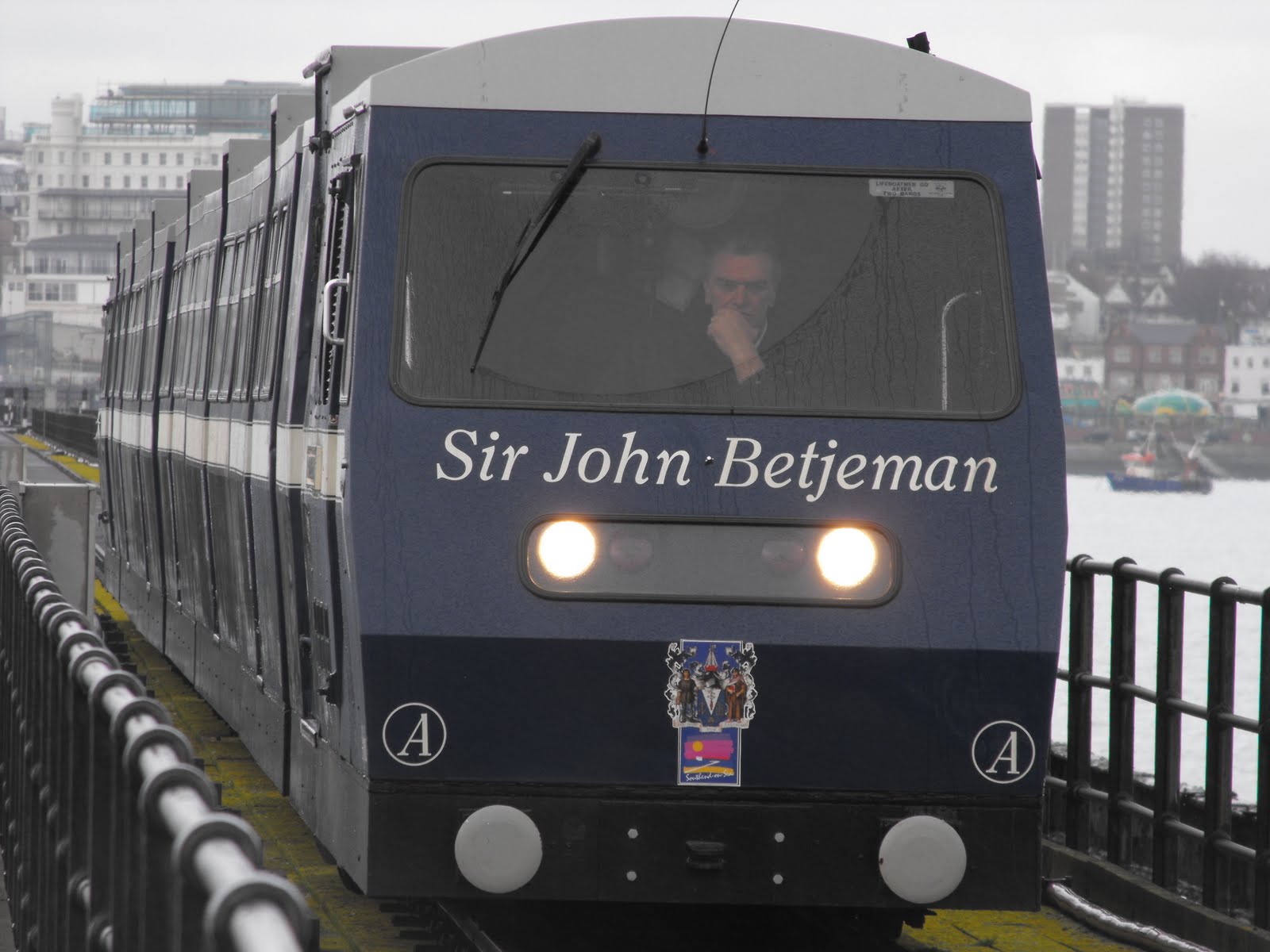
Southend Pier, the most famous thing about Southend, is over a mile long, so I decided to take the train. I emerged from the ten minute ride to find the end of pier in a squall. Everyone had taken shelter from the wind and rain in the café so there was no room for me. The sun deck was empty and views were hazy to say the least. I walked back along the pier and as I neared the land the weather improved, the sun coming out as I returned to shore.

The next part of the walk was along the cliffs to Westcliff. The cliffs are about a hundred feet high so the views over the Thames estuary are impressive if visibility is good. Clifftown is rather genteel, not a word normally associated with Southend, all white brick, large windows and wrought iron verandas. Clifftown is a Victorian era development with an obligatory statue of said Queen pointing in a rather rude manner. The Royal Terrace is Georgian, the Royal in question being Princess Caroline, the wife of the Prince Regent, a woman with a very bad reputation, who would probably feel quite at home if she visited Southend today.

The cliffs were also laid out with pleasure gardens, dating back to Georgian times and have recently been renovated courtesy of the Lottery. Prittlewell Square is a fine example of a Victorian public space with a wrought iron gateway and pond. The Cliff Lift, a funicular railway linking the cliff top with the beach, has also been restored to its former Victorian glory but wasn't open. I seem to remember that they looked quite pretty at night with fairy lights.

On reaching the Cliffs Pavillion, which does not feature in Pevsner, I returned to the seafront. I paused for a Rossi’s ice cream, another Southend speciality and continued along past the beaches of Westcliff and Chalkwall. The tide was out by now and a few people were out digging bait or walking the dog, and one very hardy couple were having a paddle!

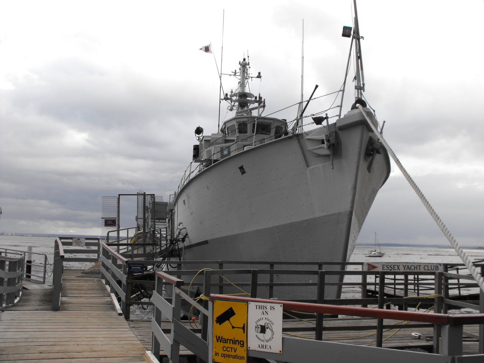
At Chalkwall Station the railway runs right next to the coast as the cliffs are quite close to the river at this point. The nature of the river and coast also changes being more industrial, with fishing boats aplenty. The large military vessel easily spotted from the train is the Wilton, a former minesweeper and now a club for yachting types. Wilton was a bit of a bargain for them as she is made of plastic and won't rust.

The London, Tilbury & Southend railway opened in 1854 and completely split the village of Leigh from it parish church on the hill. This has helped old Leigh retain its village atmosphere, with a cobbled main street and clapperboard buildings. The Old Smithy has been restored into a heritage centre and museum. Fish is still caught and sold by Leigh fisherman from the booths and shacks that line the road back to the station. The train ride back took an hour to cover the ground it has taken me three months to cover on foot. This walk marks the end of the ‘easy’ bit of the Essex coast, the Thames estuary.

To see more pictures of Southend and the rest of the Thames estuary coastline click here.