Saturday, 23 May 2015

Walking in April and May

April and May found me out and in Bedfordshire, (tent) camping in the Peak District and walking in Greenwich Park.

Bedford, Bedfordshire
Moot Hall, Elstow
I returned to Bedford by train on a day trip to visit three small museums that were closed when I visited in January. The John Bunyan Museum is a tribute to Bedfordshire's most famous son, housed in the Bunyan Meeting Church. Just outside Bedford is the village of Elstow, where you find the Moot Hall, a wonderful medieval market hall, which has miraculously survived. Elstow also has strong Bunyan connections, he was baptised and worshipped in the Abbey Church and lived in the village. The Panacea Museum in Bedford is dedicated to the Panacea Society, a rather odd religious society that flourished in Bedford in the early twentieth century. It was a wonderfully weird sort of place in the long tradition of English eccentricity.

Bedfordshire Tour 3: out and about near Bedford, Dunstable and Luton
Sharpenhoe Clappers
Making use of a little car that can go under height barriers, I stopped briefly in Dunstable, unlocked the De Gray Mausoleum, discovered the Stockwood Discovery Centre in Luton, climbed Warden Hill overlooking Luton, enjoyed one of Bedfordshire's finest walks to Sharpenhoe Clappers and visited one Bedfordshire's more remote attactions, the Glenn Miller Museum on an old WW2 airfield. (Not necessarily in that order)

Black Hill, West Yorkshire
Pennine Way
Accompanied by nephew Philip, I went to Crowden CCC site near Glossop to tackle Black Hill, the highest point of West Yorkshire, Kirklees and the former county top of Cheshire. Originally we were to be in the van, but Louis(my van) was holidaying in Brighton so we had to make do with the tent (marquee). Having got soaked climbing the hill (582m/1909ft) on Saturday, we were unable to go very far on Sunday due to lack of suitable footwear. We did a tour of part of the Ladybower reservoir on a gloriously sunny day.
Photos

Greenwich and Blackheath
Greenwich Park
This is a must for anyone living in around London. You can get to Greenwich via river boats from Central London, via the Docklands Light Railway or walk under the Thames. If you want to visit things there's the Cutty Sark, the Painted Hall and chapel in the former Royal Naval College, the National Maritime Museum and the Royal Observatory. Or, you could what my friends and I did on a lovely sunny Saturday, start at the riverside, walk up one side of Greenwich Park, over Blackheath and back down the other side of Greenwich, stopping to enjoy the wonderful view.


Thursday, 16 April 2015

Walking in March 2015

March was another chilly month but I did manage to find some sunshine along with a large amount of mud. Walks this month include London Loop, East London and Bedfordshire

London Loop section 14 -  Moor Park to Hatch End (somewhere in north west London)

Mud!!!
I'm now three-quarters of the way round the Loop and this leg turned out to be the most dramatic since 5, when I fell in the path of an oncoming vehicle. This was a fairly short walk (3.8 mls) between two outposts of the tube. It is also a very green section with very little road walking, taking in a golf course, common land and finally Oxhey Woods. It was also a very muddy section and having managed to stay upright for most of the way, I came to grief in a waterlogged field and emerged plastered in mud from toes to shoulder.
Walk directions
Photos

Touring Bedfordshire 1
Stotfold Mill nature reserve
This tour consisted of some fairly aimless driving around following brown tourist signs to closed attractions, checking out the parking for future walks and enjoying a splendid walk on a day  that felt spring-like once out of the wind. The walk was 6.8 miles near Turvey on good paths in undulating countryside with some fine views. I also had strolls at Marston Vale Millennium Country Park and Stotfold Mill nature reserve.
Photos

Walking in London 2: Mile End to Stratford
My alien friend
Katharina and I spent a Sunday afternoon strolling from Mile End to Stratford, about four miles or so. Points of interest are Mile End Park, Regents Canal, the Arts Pavilion where we were abducted into an exhibition on Spirituality in Modern Art, Victoria Park, the Greenway, tea at the View Tube, finishing up in the Queen Elizabeth Olympic Park at sunset.
Photos

Touring Bedfordshire 2
Willington Dovecote (NT)

At the end of March I spent four chilly days touring the villages around Bedford with a very accommodating friend. We did enjoy a very enjoyable walk (4 miles) from Houghton Conquest to Houghton Hall (EH) and back via King's Wood.  Other places we visited were; Willington Dovecote (NT), Stevington Windmill, Bronham Water Mill, good spot for a picnic, Harrold Odell country park, another good picnic spot. If you are a fan of churches don't miss St Margaret of Antioch Church in Knotting and transport yourself back to the seventeenth century.

Discovering Bedforshire: the Shuttleworth Collection
The Swiss Garden
The Shuttleworth Collection is must for aircraft enthusiasts due to variety of very old aircraft and the fact that most of them still fly. You can also visit the Swiss Garden, recently restored at vast expense. Children get in for free and there is a very large playground that you can access for free.


Sunday, 1 March 2015

Walking in February 2015

February has been quite chilly but I still found a fair bit of blue sky while out walking in Essex mostly.

Turvey, Bedfordshire
14th century wall painting

Turvey may be on the border with Buckinghamshire but it is in the heart of Midsomer. I was half expecting to stumble on a film crew as it is very picturesque village.
Photos

Chipping Ongar, Essex


Log Church, Greensted
Chipping Ongar is a small market town about 20 minutes drive from the Harlow turnoff on the M11. Parking by the library in free at weekends and there are cafes and toilets nearby. The Millennium walk highlights its historic interesting building and the wonderful Log Church at Greensted is about 20 minutes walk along the Essex Way.
Other attractions include the Epping Ongar railway and the Secret Nuclear Bunker.
Photos

Colchester, Essex


Colchester Castle
Colchester is allegedly the oldest town in Britain and home of Essex's most popular tourist attraction (Colchester Castle). Camulodunum was the capital of Roman Britain and the town abounds with Roman remains. The castle keep is the largest in Britain, very well preserved and contains a lot of recycled Roman masonry. This walk links the town and country parks, both excellent in their different ways. Lots of things to see and do, museums, art galleries, old buildings, historic port area and zoo.


City of London


Photos from a short circular walk from Blackfriars Station on a cold, sunny Sunday afternoon.


Mersea Island, Essex

Beach huts on Mersea Island
Mersea Island is an Essex holiday playground about 10 miles south east of Colchester. It's a rather old fashioned place with beach huts and caravan sites and not a lot to do except enjoy the beach. It's good for walking with a footpath running around the whole coastline. Cudmore Grove Country Park is at the east end of the island, good for picnics, bird watching and beach walks. West Mersea is famous for sea food, you can enjoy oysters at the Company Shed.

Great Bardfield and Finchingfield, Essex
Finchingfield

Great Bardfield and Finchingfield are two delightful villages in North Essex a couple of miles apart. Finchingfield is the best known and featured in last years Tour de France. Both have pubs, restaurants and cafes and make excellent stops for tea and a wander.
Photos

RSPB Sandy, Bedfordshire
The Swiss Chalet, Gatehouse of the Lodge
The Lodge at Sandy in Bedfordshire is the headquarters of the Royal Society for the Protection of Birds. Apparently the house was going cheap in 1961 and they bought it for a song. There are nature trails through heath and woodlands on the Greensand Ridge. The Lodge itself has a fine formal garden and one of the largest Redwood trees in Bedfordshire.

Tuesday, 3 February 2015

Walks in January 2015

For 2015 I have several themes and schemes to help me plan walks and camping trips. I'm working my way through Essex walks, one of the excellent Pathfinder series, so most Saturdays you will find me trudging round my home county. 

2015 is also Discover Bedfordshire year (well in Jillworld, it is). It is all part of my cunning plan to conduct a Grand Tour of Britain. Deciding not to wait 2950 days till my retirement, I'm starting at the beginning of the alphabet in tiny little Beds. On my to-do list are walks, historic houses, museums and industrial heritage. I also hope to find some interesting but less well known sites and scenes.


Waltham Abbey, Essex

A pleasant place for picnic, lunch or tea. Abbey gardens, fine old church, King Harold, local museum old pub and teashop. Info

Lee Valley Park - acres of lakes for birdlife, canoeing, wild water rafting, great for walking or cycling, plenty of pubs and cafes. Easily accessible by public transport. The Lee Valley Walk is one of the capitals strategic routes and well worth exploring.
Photos


Epping Forest, Essex
View from the View


Epping Forest stretches from Newham in the south, through Waltham Forest to Epping in Essex. Queen Elizabeth Hunting Lodge where we based our walk is easily accessible by public transport from Chingford.

Hanningfield Reservoir, near Chelmsford, Essex


Largest reservoir in Essex with nature reservevisitor centre and cafe
Photos

Pavenham, Bedfordshire
A view across the Great Ouse Valley south towards the Chilterns

A short walk from the Pathfinder book a few miles west of Bedford.
Photos

Bedford, Bedfordshire
View from the Castle Mound
I've just spend two of the chilliest days this or any other year exploring the delights of Bedford, former county town and charter borough since 1166. Day one was spent following the town trail and the second a walk around the southern part of the town from the Pathfinder book. Bedford has a most attractive river front and the Higgins Art Gallery and Museum was more interesting than I expected.

Monday, 4 March 2013

Barking & Dagenham - Countryside


Eastbrookend Country Park 

My latest walking challenge is to get out and about in Greater London, discovering the countryside and cultural heritage that is on my doorstep. What better place to start with than my home borough of Barking and Dagenham, (henceforward known as LBBD), it's the nearest and the first on the alphabetical list of London Boroughs. You may think that LBBD is not fertile territory for either culture or countryside but read on and you may be surprised.

Countryside
Less than one hundred years ago Dagenham was all farm land, indeed there was a market garden at the end on my street in the sixties. The far north of the borough has some actual farmland but there is little real countryside. What we do have is the Dagenham Corridor, a green strip in the east of borough made up two country parks, two nature reserves, one open space, and three parks. You can walk from the Ford Factory on the A13 to the Peace and Memorial Garden in Central Park crossing just two roads and a railway line, a route of about four miles.

Eastbrookend Country Park has been brought the land back to life since it was created in 1995. The area was used for gravel extraction and then the holes either filled up with water or were filled up with assorted rubbish, including rubble from the Blitz. I remember it from my childhood as a toxic wasteland. I was very sad to discover that the seven Park Rangers are to lose their jobs, a part of the Council's cost cutting measures. The Country Park is something for the borough to be proud of and I hope that all their hard work is not sacrificed on the altar of George Osbourne's fiscal policy.


The Chase
With so much water around The Chase Nature Reserve is a haven for wild fowl. On the day I visited it was mostly swans, but apparently there are skylarks in summer. The Chase is also home to very rare Black Poplar, which looks a bit like a young Whomping Willow. The other nature reserve in the Corridor really is on my doorstep. The local Parish churchyard is no longer used for burials and is now managed for the benefit of nature. Know as God's Little Acre, the meadow will be full of wildflowers in spring, so I must remember to take a look. Rippleside Nature Reserve occupies some derelict land next to an electricity sub-station in Barking Riverside. There is a little wood of Silver Birch that has colonised the area as apparently they don't need much in the way of topsoil.

Thames riverbank
The best kept secret in LBBD is the Thames riverbank. It has taken me years to find out how to get to this remote footpath, a little oasis of green between Dagenham Dock and Creekmouth. How long will it remain remote, secluded and peaceful? There are plans to build many new homes on derelict land nearby. There was another riverside open space at Creekmouth where the Roding joins the Thames, with picnic benches and steps down to the shore.

LBBD is blessed with some very large parks throughout the borough with an assortment of attractions. In my youth it was a real treat to visit Barking Park and ride on the little train (still there) or on the paddle steamer on the lake (not so sure that is still there). London County Council who built the Becontree estate created three large parks, Parsloes, from the old Parsloes Manor estate, Mayesbrook and Central. I doubt whether todays developers would be so generous or thoughtful to the needs of the residents. A BMX track is a recent addition to Old Dagenham park, my local.

Matchstick Island, Mayesbrook Park
Walking in LBBD

Sadly none of the seven strategic routes promoted by WalkLondon pass through LBBD, although one day the Thames Path North East Extention might (it was part of the Olympic plan). This idea was to extend the Thames path from Canary Wharf to Purfleet. May happen one day! The only self-guided route accompanied by a little booklet is the Timberland Trail around Eastbrookend Country park and the Chase. My booklet was about ten years old and most of the waymarks seem to have disappeared. LBBD produced a helpful leaflet on the Dagenham Corridor but it isn't available on pdf.  Eastbrookend, The Chase and the Beam provide us locals with a little bit of countryside to enjoy, it may not be the prettiest bit of open space in London but it'll do.

Click here for more pictures of LBBD

Sunday, 27 January 2013

Three Forests Way


Hainault Forest
This winter I completed a 60 (95km) mile circular walk called the Three Forests Way, linking the ancient Essex forests of Epping, Hainault and Hatfield. This walk was devised by ramblers in 1977 to celebrate the Queen's Diamond Jubilee. The official start point is Harlow in the west of Essex. The route then follows the River Stort north to Hatfield Forest and then turns south via the Roding Valley and Hainault Forest to Loughton. From here it goes over the high ground north of Epping, and beside the River Stort back to Harlow.

The route isn't waymarked so I had to rely on the guidebook published in 1986, OS Explorer Maps 174, 175, 183, 194 & 195 and my two GPS's. I abandoned the guidebook after failing to identify 'a group of three trees' in Epping Forest. It wasn't too hard to get round as the route was marked on the Explorer maps. Most of the walking was off-road or on quiet lanes, with only one very short section on a busy road. It was surprising how easy it is to walk for a couple of hours without crossing a road or seeing a soul so close to surburbia.

Epping Forest stretches from the Olympic Borough of Newham to the south west borders of Essex. It's been owned and managed by the Corporation of London on behalf of us citizens since 1876. It is very well-used by walkers (with and without dogs), riders (of bikes and horses), model airplane owners and motor cyclists who congregate at the tea hut near High Beach. It's not a place for quiet comtemplative walking as you are never too far from a busy road. Nethertheless you can still get lost in the denser parts of the forest. Epping was a Royal Forest in Tudor times, Queen Elizabeth's hunting lodge is well worth a visit.

Hainault Forest has been a public open space since 1906. The country park part is the London borough of Redbridge, the Woodland Trust manage the part that lies in Essex and the bit in Havering is a public golf course. All three local authority boundaries meet at Cabin Hill, the highest point in Redbridge, 90m/205ft. The country park recently hosted 3,000+ troops in a Snooze Box Hotel, as part of the Olympic security organisation. This is another well-used open space and one that gives excellent views into London. On a clear day, the Shard, the Gherkin, the Telecom Tower and London Eye are all visible.

Hatfield Forest lies just south of Stansted airport. This was also a former Royal forest acquired by the National Trust in 1923. As it lies under the flight path of London's third airport, noise can sometimes be a problem. On the day I visited the cloud was so low the planes weren't visible. It's an excellent place for walking, with two waymarked trails and plenty of trees to get lost in. The large picnic/parking area is popular for family picnics. Wildlife abounds, deer in forest, duck on the lake and cows in the pasture.

Several other long distance routes share parts of the Three Forest Way; section 19 of the London Loop from Hainault to Chigwall; the Centenary Walk in Epping Forest; The Forest Way - waymarked route linked Epping and Hatfield Forests; The Stort Valley Way - a circular path between Epping and Harlow; The Essex Way and St Peter's Way near Ongar. Apart from the forests and fields, there is a very pleasant riverside section by the river Stort from Roydon to Sawbridgeworth.

I started this walk on a mild sunny day in November and finished on a snowy Saturday in January, covering a total of 65 miles (100km) in nine walks. The longest was 11 miles and the shortest was 4 miles. Mostly I used public transport, sometimes combined with the van so all the walks were linear. I experienced the whole gamut of British winter weather; sunny and cold, sunny and mild, light rain, heavy rain, floods, icy winds and snow. It took about 26 hours to complete the walk.

Highlights: nearly missing a herd of fallow deer that passed directly in front of me as I read the map, one large stag with twenty or so does; the beautiful sunny but cold morning spent walking from Roydon to Sawbridgeworth; the polar bear in Hatfield Broad Oak.

Lowlights: the toilets at Harlow bus station; wading knee deep through a flooded field; mud.

Snowy Essex

Click here for more photos

Sunday, 13 January 2013

The Thames Path - Hampton Court to Dartford

In 2009 I walked the London section of the Thames Path National Trail from Hampton Court in the west to the official start/finish point at the Thames Floor Barrier. I also did the southern extention to the Darenth Flood barrier in the shadow of the QE2 bridge at Dartford. (We are still waiting for the northern extention to Purfleet to be completed). The Greater London section is about 67 miles (107km) covering both banks of the Thames. I covered the distance over six days which weirdly included the hottest and coldest days in London  that year.

The Thames Path makes for excellent walking; it's flat, it's easy to find and get to, there are plenty of places to eat and drink, but mostly it's the variety of the views, meadows, parks, boats, bridges and the buildings to numerous to mention. As the path is also a cycle route in part, WATCH OUT FOR BIKES!

Walk London produce some excellent leaflets covering the route.

Click here to see photos

Tuesday, 28 February 2012

Fun and frolicks on the South Downs


I chose Brighton for my first camping trip of the year for several reasons, not least, meeting up with former colleague Robbie. Two weeks ago Britain was in the grip of a new ice age so I was relieved when temperatures started to rise. The chosen campsite, Sheepcote Valley, is to the east of Brighton, handy for Brighton Marina. It was full so it was lucky I booked.

The first part of my trip was to bag Cliffe Hill, a Marilyn, which is rather tricky as the summit lies on the 12th green of a local golf course. My plan was leave very early, avoiding the toll at the Dartford Tunnel, get to Lewes around dawn and using the element of surprise, get onto the golf course before any of the golfers. It was a good plan and it got off to a good start, as I arrived in Lewes around 7am. The hills were helpfully shrouded in cloud which would provide some useful cover when trespassing on the golf course. Then things gradually fell apart; I was too early for the car park; I was in the wrong part of town; I got lost getting to right part of town. The church clock was chiming eight when I finally headed up Chapel Hill on the very steep climb up the downs.

The downs were still helpfully shrouded in mist as I made my way across the golf course on a footpath. I left the footpath and headed to the top but lost my nerve and exited the golf course to see if I could find another way. I wasted another half an hour before deciding the only way was to brazen it out. By now golfers, singularly undeterred by limited visibility, were everywhere and the cloud cover starting to lift. I lurked behind a bush until the green had cleared of players, before leaping out to take my photo and get the hell out of there. I'm suprised no one had called security to get me evicted as I kept bumping into the same group of golfers, whilest assuring everyone I wasn't lost.

On my return to Lewes I had a wander round, bought something to read from a charity shop and had a cuppa. Other things I might have done; visit the castle, visit Anne of Cleeves House, take a walk by the river or shop for antiques. Lewes is pleasant country town and a good base for touring the South Downs, the newest of our National Parks.

The weather was mild but rather gloomy so I settled into my van with a good book, The Other Boleyn Girl by Philippa Gregory, but alas no food as I'd left the soup behind. Saturday morning was also rather drizzly so I stayed put reading until I noticed that the van was rather warm, a sure sign that the sun had come out. I emerged blinking into the sunlight and headed off to the Marina, which was a bit like Brent Cross with boats. I thought about going to the cinema but opted for a bracing walk eastwards along the coast to Rottingdean, with bus ride back to avoid walking into the sun.

The sun was shining brightly on Sunday when I returned to Lewes to meet up with Robbie. We walked up Chapel Hill to the golf club and then onto the open downs above Lewes, eventually climbing up Mount Caburn, a much nicer hill than Cliffe. There are views along the South Downs to Ditchling Beacon to the west and Firle Beacon to east, both Marilyns I'd climbed with Noddy the dog. Robbie and I continued down the hill to Glynde for a pub lunch and caught the train back to Lewes. We'd probably still be chatting now if Robbie's wife had not rung to offer him a lift home.

Sunday, 8 January 2012

The Saffron Trail - Parts 3 and 4


From Battlesbridge the Saffron Trail heads north over rolling countryside to Danbury and then west to Chelmsford, the county town. Section 4 starts in the centre of the city following the river Can west through parkland and then north along the route of the Centenery Circle, finishing in the pretty village of Great Waltham. Due to the length of the route and the shortness of the days in December, I covered the distance over three days.


I set off from Battlesbridge on a glorious winter day, clear blue skies and a biting polar wind bundled up in four layers of clothing. I soon warmed up as the Trail went up and down over several small hills. The ground was frozen and the stiles were slippery adding a frisson of danger to the expedition, at one point I nearly skidded off a plank bridge. The first four miles are across open countryside along field edges with some wide open vistas. The route passes through a deserted churchyard just south of East Hanningfield. The old church burnt down in 1883 and was rebuilt in the village rather than on the old site.

After a brief stop at the new church, I continued on to Danbury, a large Essex village on a hill (367ft/112m), said to be the highest point (at that latitude) west of the Urals. Danbury has a fine church with a tall spire (unusual in Essex) which you can spot from the A12. There is a panoramic view from the war memorial, mostly of Chelmsford unfortunately. Danbury is an excellent place to go walking as it is surrounded by accessible land. The Saffron Trail goes over part of the Common, now owned by the National Trust. Nearby is Danbury Country Park where I left Archie on the second day of the walk. Set within the grounds of Danbury Palace, there are ponds, woods and meadows, a good place for a picnic.

I returned to Danbury on Christmas Eve with the hope of getting to Chelmsford inside 2½ hours, arriving as dawn was breaking. However a combination of a head cold, the cold weather and getting lost in the country park meant I didn’t get quite as far as I intended. The trail heads north from Danbury down a really steep path to Lingwood Common, also owned by the National Trust. It then passes through a beautiful meadow in the grounds of Riffhams, a Grade II listed building. I spotted a bunch of cross country enthusiasts disappearing into the distance. The Saffron Trail shares part of its route with the Admiral McHardy Way, named after the founder of the Essex Police Force.

The last couple of miles west into Chelmsford are along Grace’s Walk, a dead straight bridleway and then along the banks of the river Chelmer, which were rather muddy. The river was canalised in the eighteenth century and linked Chelmsford with the open sea via Chelmer and Blackwater navigation. Back in the 1980’s I organised a trip along the river for my library colleagues from Paper Mill Lock. You pass three different locks on the Saffron Trail and I spotted several narrow boats at moorings. The only river traffic apart from ducks were canoeists from a local club.

I abandoned the Trail at Barnes Mill Lock and headed back to Maldon by bus. I returned on another cold day, enlivened by some blue sky and the occasional ray of sun. The idea was to quickly finish off section three and then continue onto Great Waltham. However fate played a different hand. The usually exemplary instructions were a little ambiguous and I ended up walking a mile along the river Chelmer rather than the river Can. I discovered that Chelmsford has some very pleasant waterfront areas. Amazingly I don’t think I ever been to town centre before. Chelmsford is currently applying for official city status as the Queen will create several new cities as part of the Jubilee celebrations. It does have a cathedral which I suppose is a bit of a head start.

The canoeists were out in force along the River Can and there were plenty of dog walkers, cyclists and locals out and about in Bell Meadows and Central Park. A little further west is Admirals Park and Tower Gardens where I stopped for a mid-morning rest. The Saffron Trail follows the western edge of Chelmsford north on a series of footpaths and bridleways that form part of the Centenary Ring, a 21 mile circular walk, devised to celebrate a hundred years as a borough. Nothing very exciting happened on the way to Great Waltham. I stopped at the Walnut Tree for lunch but they weren’t serving food so I ate my emergency salmon sandwich surreptitiously while enjoying the warmth and a pint of lime and soda. This time I managed to arrive in Great Waltham five minutes before the bus and headed home.

Battlesbridge to Chelmsford 14¾ miles
Route details


Chelmsford to Great Waltham 7 miles
Route details


Click here to see more photos

Sunday, 11 December 2011

The Capital Ring


Back in the autumn of 2009 when I was a woman of independent means I spent ten days walking around London via the Capital Ring.

The Capital Ring is one seven strategic walking routes promoted by the Mayor of London and the local authorities. The routes are well signed, with leaflets freely available from Walk London and accessible via public transport. Ideal for unemployed Londoners! The Ring is 78 miles long and encircles London within a 4-10 mile radius from Charing Cross.

So if you want to take a trip around London's highways and byways, green lanes, bridleways, footpaths, towpaths, rivers banks, docklands, parks, country parks, recreation grounds, golf courses, cemetaries and sewers, commons, estates ducal and regal, click
here.


The Saffron Trail - Part 2


Hockley to Battlesbridge

The next section of the Saffron Trail meanders through Hockley Woods, up over a small hill with excellent views of the Crouch estuary and turns north on farm tracks towards the riverside. The route then heads west along the sea wall towards Battlesbridge. Sadly the last half mile is along a busy pavement-less road. I have walked most of the route on a previous trip to the area on my way around the Essex coast. The weather was much more wintry than of late, but with the occasional burst of sunshine accompanied by a chilly wind. In 1838 a medicinal spring was discovered in Hockley and the pump room was built in 1842. It might not be impressive as pump rooms goes but this building must have made quite an impression when new. Sadly Hockley did not become the Bath of the East.

Navigating your way through woods is not easy when the paths are covered with leaves so you need to pay close attention to the instructions in Hockley Woods, which were spot on. There are some fine views across the Crouch estuary from the top of a little hill and I enjoyed picking out landmarks from previous walks. You reach the sea wall at the recreation ground in Hullbridge. I watched a curiously mismatched game of football where a team of very small boys took on a team of very large boys. The next couple of miles along the sea wall were rather chilly. The river was rather quiet with only a few yachts to rival the swans (Hullbridge has a lot of swans).
The end point is Battlesbridge, the antiques mecca of Essex. I climbed to the top of the old mill (not for the faint-hearted) to enjoy some splendid views in the cafe, despite the howling wind. After enjoying a tuna sandwich I strolled off to the nearby station in good time for the train home.

8.5 miles 4 hours
Route details

Click here to see more photos

Sunday, 20 November 2011

The Saffron Trail - Part 1


Southend on Sea to Hockley

The Saffron Trail, a route devised by Essex Ramblers, runs across the county for 72 miles from Pier Hill in Southend to St Mary's Church in Saffron Walden. I've chosen this route for my winter walking as it's closer to home than the Essex Way. I got off to a glorious start this Saturday, with sunshine from dawn to dusk. It was so warm I nearly had a Rossi's ice cream for breakfast. Setting off from Pier Hill, the Trail heads westwards along the cliff top to Westcliff (wonder how they thought up that name), then along the promenade to Old Leigh. I'd walked this way in 2010 on my way around the coast. From Leigh, the Trail heads back up the cliffs via the Belton Hills nature reserve. There are fine views up and down the Thames Estuary. Having climbed up the hill, the route went back down again and into Hadleigh Castle Country park. The castle was a favorite home of Edward III and subject of a painting by Constable. Alongside the country park is Hadleigh Farm, the site of the Olympic mountain bike course. Most people will not associate Essex with mountains, but having walked up the hill I found it quite steep. I'm looking forward seeing the event next year. I had lunch (tuna sandwich) alongside the replica iron age roundhouse and enjoyed a sunny rest stop before tackling the second half of the walk.

The route between Hadleigh and Hockley consisted of several areas of open space, Hadleigh Great Wood, Edwards Hall Park and Hockley Woods, linked by the street walking through the suburbs of Southend. On the whole it was quite pleasant walking particularly the last few miles. The Saffron Trail is not a waymarked route so you rely on the accuracy of the description to avoid getting lost. Mostly the instructions were clear and concise, however at Edwards Hall Park, they went a bit awry. I was invited to head west towards a communication mast, when in it should have been east! Also, a mast might not be visible in poor weather. On the way to Hockley there were some very fine views across the Crouch valley with wonderful Canewden church clearly visible. At the end of the walk I enjoyed an ice cream before heading off the station to miss the train home.

14 miles 6.5 hours
Route details


Click here to see more photos

Sunday, 13 November 2011

Fog, mist or low cloud....


White Notley to Coggeshall 6½ miles


The weather was decidedly gloomy for the next leg of the walk and increasingly misty the deeper into Essex I travelled. It was cool but not really cold when I got off the train at White Notley. Note to self: when travelling to this station be at the back of the train. I was in the front carriage and I swear it took me five minutes to walk the length of the platform to the exit. The end of the train wasn’t even visible due to the mist. This leg to Coggeshall included the usual footpaths and bridleways as well as two short stretches alongside busy roads. The John Ray Walk shares this part of the Essex Way, established to commemorate the life of a natural historian and Essex man of the seventeenth century.


By Fambridge Hall, I spotted a couple of pigs enjoying their mudbath, however one of them ruined my shot by getting up. Twenty minutes after leaving the station I found myself back there again, just in time to see the train on its way to Liverpool Street! The mist/fog/ low cloud prevented any views at all on the way to Cressing, where I stopped for some refreshment at the church. I passed the time of day with the man who had come to repair the roof. (Please sign this petition re metal theft). Near Cressing but not on the EW route are Cressing Temple Barns. The Wheat Barn,brick-built, and the Barley Barn, weather-boarded, were built by the Knights Templar in the thirteenth century. Attractions include a walled garden and a tea shop.


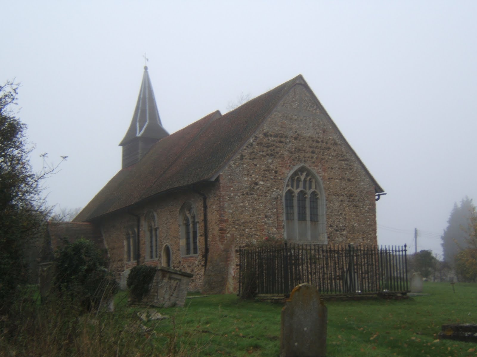
Next rest stop was Bradwell Church, another typical low church with a small broach spire. This one also had some medieval wall painting but was firmly locked. The route between Cressing and Bradwell was shrouded in mist and I managed to lose the Way again, just briefly by not paying close attention to waymarks. I don’t think this section is the most scenic though, passing an active gravel pit and a tip. From Bradwell , the Way follows the Blackwater valley for a couple of miles but the river was masked by trees.


Arriving at the Grange Barn in Coggeshall, I decided to call it day and catch the bus back to Braintree. Coggeshall is a village full of in interesting architecture, best saved for a brighter day. The number 70 was nearly ten minutes late and I arrived at the bus station with one minute to catch the train. I missed the train by four minutes and was marooned in Braintree for an hour. Time for a late lunch (ham sandwich, banana and orange juice from Sainsbury) before heading home. Coggeshall marks the halfway point along the Essex Way and I intend to resume the walk next spring when the days are longer.


Some Essex Way facts
Progress along the route 41 miles. Total miles walked 53.5 miles.

Click here to see more photos.

I Don't Care What The Weatherman Says....


Great Waltham to White Notley 11 miles


Despite a dire weather forecast I set off at dawn to return to Great Waltham for the longest leg yet, to White Notley. Fortunately my magic umbrella managed to repel the predicted heavy rain. I got off the bus in GW to be greeted with blue skies and weak sunshine, another perfect day for walking. The village has some interesting architecture including this lovely old Tudor house.


The first part of the walk was through the grounds of Langleys, a grade 1 listed pile of the Queen Anne period. There was a pet cemetery at the end of the drive and an ornamental bridge over a water feature. Once out of the grounds, the Essex Way heads north and then east through several hamlets and villages on a variety of footpaths, bridleways and quiet lanes, with thankfully, only one muddy field to cross.


The first rest stop was at the church in Little Leighs, where I had to take refuge in the porch from the light rain. I spotted a pheasant showing off in the churchyard. I mislaid the Essex Way for a bit while crossing over the A131, not helped by the fact that new road wasn’t marked on my old map. However whilest off route, I did spot this strange sculpture from the bridge, variously described as orange ladybirds or giant beetles. It could be a bit off-putting if you catch sight of them while driving towards Braintree.


Following the valley of the River Ter, I had to deal with ten stiles in a mile and half stretch through various fields and pastures inhabited by horses, individually and in herds. After all that climbing, I was ready for another sit down at Great Leighs church. This church has a lovely Norman round tower on which some Victorian ‘improver’ has stuck a wooden spire. It looks like a witch's hat. Round tower churches are found only in East Anglia and this is one of only six in Essex. Round tower churches have their own society!


I passed the only pub on route a little before opening time but was deterred from waiting by a stern muddy boot warning. So instead I had a rather meagre snack (fruit, dried fruit and a Tracker bar) at the bus stop at Flack’s Green, Terling. Terling has one of the few smock windmills in Essex but I managed to miss it. The ford through the mighty river Ter was quite pretty. The weather started to change in the afternoon, clouds thickened up and it grew cooler and darker.


Last rest stop of the day was Fairstead church, which contains Roman brickwork and a little broach spire so typical of Essex churches. It also has some very old wall paintings, but I didn’t venture inside as my boots were rather muddy. The last couple of miles were completed at a goodly lick to ensure I didn’t miss the hourly train at White Notley. The effort was wasted as the train was delayed (by a car striking a bridge). Despite dire warning and leaden skies, I managed to get six hours of walking without getting wet. That magic umbrella really does work.


Some Essex Way facts

Progress along the route 34.6miles. Total miles walked 47.5 miles.
14 stiles on this leg

Click here to see more photos.