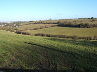
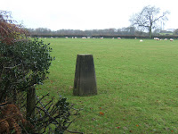
Thursday 26 February 2009

Alternative Surrey 3 - Kingston-upon-Thames

Telegraph Hill (Kingston-upon-Thames) 295ft / 90m

I don’t know if any one else thinks it odd to find reservoirs on the top of hills but there seems to be a recurring theme here (Nottinghamshire, Harrow etc). Telegraph Hill is securely locked away by Thames Water with a very large fence guarding the covered reservoir and telecom masts, de rigeuer for any self-respecting top these days. Telegraph Hill also had a prison-like watch tower. Makes you wonder what they are hiding!

I knew from the hill bagging website that Telegraph Hill was pretty impregnable but it didn’t stop me from having a go. My plan was to assault in the rear by walking through Prince’s Covert, part of the Crown Estate. But first I had to apply for a permit to enter the estate, once the property of Prince Leopold, husband of Princess Charlotte, only daughter of the Prince Regent. Stumping up £5 (refundable) I received my key (no. 1732) and a handy map showing a 3½ mile guided route, I set off to Leatherhead and my campsite.

My pitch was under water after the recent snow but the hardstanding was firm underneath. After one of the coldest nights of the year, Archie was marooned on a little ice floe. I didn’t rush off, waiting for the promised sunshine. I let myself in with key wishing I brought some WD40 to make the lock close more easily. Then I then spent the afternoon with the place pretty much to myself as I saw less than ten people. It was very peaceful with just the odd jet plane disturbing the silence. It’s remarkable how you get away from the madding crowded in a densely populated place like Surrey. It wasn’t very picturesque as it was largely heath and plantation and would be easy to get lost in without following the signs or the map.

Needless to say I couldn’t get access to Telegraph Hill. I got within 500ft but between the reservoir fence and me was a trap shooting range and a barbed wire fence. All that just to protect some water!

Tuesday 24 February 2009

Alternative Surrey 2 - Richmond & Merton

I left Archie behind for this walk which would take me from Wimbledon Station, over Wimbledon Common, through Richmond Park and finally along the River Thames to Richmond Station, about 9 miles in total.

Lauriston Place & Wimbledon Common, (Merton) 180ft / 55m

Lucky old Merton has twin peaks, the first was unobtainable in the back garden of the very large house with the Dutch gable end. The second one was an unmarked spot height in the middle of a scrubby bit of Wimbledon Common, known only to the Wombles. Very unsatisfactory topping, no views and not much of a hill. However I did spot this interesting road sign.


Richmond Park (Richmond) 184ft / 56m

Once I had despatched the Merton tops, I set off towards Richmond following the Capital Ring across Wimbledon Common. As the morning wore on the sun came out but it was pretty cold. Wimbledon Common was alive with activity; dog walkers, strollers, hikers, joggers and runners, cyclists, horse riders and golfers. Not a place for quiet contemplation.

After crossing the A3, I entered Richmond Park via Robin Hood Gate. Richmond Park is London's largest park and seemed even busier than Wimbledon. However away from the gate the crowds thinned out a bit. I spotted some deer posing in the sunshine below the wonderfully named Spankers Hill Wood. I followed the Capital Ring past White Lodge, home of the Royal Ballet School, over the lake and up the hill into the woods. The trig point which marks the highest point is just to the north of Pembroke Lodge (posh cafĂ©) and just to the east of King Henry’s Mound. As the Mound is definitely higher than the trig point, I assume it doesn’t count as a top as it’s man made. It makes a more impressive top though, with its keyhole view back to St Pauls 10 miles away. St Pauls is framed by an avenue of trees and the view is protected by law. There was a equally impressive view to the west as Richmond Hill fell away to the river. It was too murky to spot Windsor Castle on the horizon, but there were plenty of other points of interest visible.

I wandered down the hill through Pembroke Lodge gardens, through Petersham meadows, along the Thames Path to Richmond Bridge. I collapsed into a seat on the train at Richmond nearly five hours after leaving Wimbledon Station and let the District Line carry me home.

Sunday 22 February 2009

Alternative Surrey 1 - Croydon & Sutton

Clock House (Sutton) 482ft / 147m

After ticking off Botley Hill in all its manifestations, I went on to camp at Alderstead Heath, intending to walk to the top of Sutton the next day. That day dawned sunny and bright, so I set off in good heart to walk the three and half miles to Clock House. What I hadn’t realised was just how hilly this part of Surrey is as there were two hills in between. The walk to Coulsdon followed the route of the London Loop over Farthing Downs, with some excellent view back towards London and Hampstead Heath on the horizon. However for much of the time it was possible to forget surburbia and just enjoy the beautiful open countryside. Farthing Downs would have made an excellent top for Croydon, were they about eighty feet higher.

It was uphill all the way from Coulsdon until reaching Prospect Plantation where the land levelled off. The actual top was the Clock House recreation ground and luckily the football pitch was deserted as I wandered around like a prospector trying to find the highest point. I was able to enjoy the sunshine and have a picnic in the kids playground, also deserted, before returning by the same route. The walk was ten miles long, took over five hours to complete and climbed over 1200ft. Bloody knackering!

Sanderstead Plantation (Croydon) 574ft / 175m

In contrast with the Sutton walk, the Croydon walk was all over in about twenty minutes. In parked in Church Way and walked to the top of Sanderstead Plantation. The path was steep but mercifully short. There were a few views towards London but otherwise it was all trees and scrub. It was very popular with locals and I think I spotted a fellow topper, a man armed with gps and maps.

I wonder if this is what happens if I put Archie on steroids!

Friday 20 February 2009

The Surrey Marilyns

Botley Hill, Parts One, Two and Three

Surrey has one other Marilyn besides Leith Hill, the county top. Botley Hill (876ft / 255m) is more a plateau than a hill with some very steep sides but quite level on top. So level in fact that is quite hard to work out where the highest point is and last October, the ‘top’ was relocated to its present position, near a water tower and ubiquitous radio mast. This is a bit of a bummer for everyone who has visited the former location, a trig point near the Woldingham Road, me included, who will now have to troop out to Surrey the bag the new top.

I had visited Botley Hill One on a mild, grey day in December 2006 on my way to bag the top of Kent. It was only about a sort distance from where I left the van. Easy and convenient! In January 2009 I returned to the same car park near Titsey Place hoping to combine Botley Hill Two (the relocated top) with Botley Hill Three (the former county top of Greater London). On a day with better weather and more time this would make quite a good walk. However, on the chosen day it was hard to tell if the North Downs were cloaked in high mist or low cloud. With visibility was down to 100 metres there was a real chance of getting lost. It was so bad I had to wear my high visibility jacket.

Botley Hill Three (837ft / 255m) is a point in someone’s back garden which was part of Greater London between 1965 and 1993 before Surrey reclaimed this area with a boundary change. It took me just over 30 mins to walk to Waylands House, peer over their wall and take the obligatory photo. It was so misty I probably could have wandered around their garden unapprehended but I had to make do with getting within 150 feet. Topping can be very silly at times!

I decided to relocate Archie to another car park within half a mile of Botley Hill Two. However I missed the turn off and had to drive all the way round the hill via the village of Woldingham. It looked and felt more like the Peak District than Surrey. I imagine there was quite a nice view from the car park as it was atop the scarp side but visibility here was down to a few yards. It was still possible to hear the M25 less than a mile away though. Botley Hill Two is just off the Vanguard Way and the actual top was barred by very large fence and some severe warnings protecting the water tower and telecom masts. No views here either, even in good weather.

Tuesday 17 February 2009

Surrey - with the tower on top

Highest point in Southern England?

Surrey is quite a hilly place by southern standards, with the North Downs running across the whole of northern part of the county. At 965ft Leith Hill is not quite the highest part of southern England (that honour goes to Walbury Hill by 9ft) but it doesn’t stop the National Trust from advertising it at such. The hill is crowned by a 18th century Gothic tower which affords panoramic views as far as the English Channel. Apparently on a clear day you can see 13 counties. But on this particular day I could see only one.


I had to abandon the planned walk due to the dreaded height barrier (alive and well in Surrey) so Noddy and I walked from the Windy Gap car park up the staircase to the tower. This was a climb of over 200ft in a quarter of mile and left one of us rather breathless. The gatekeepers kindly kept an eye on Noddy while I climbed up the tower, but despite being a warm dry day (a bit of rarity in 2007), it was far too hazy to see more than a few miles.


Surrey has lots of very big, very posh houses some of which you can visit, like Polesdon Lacy near Leatherhead. Only the gardens were open in winter as the house became the latest location for Midsomers Murders. I didn’t see any of the cast at work but I nearly reversed over Tom Barnaby’s wife as I was extricating myself from the car park. There were some excellent views back towards London. National Trust members are spoilt for choice in Surrey with a fine selection of houses, gardens and open spaces to choose from.


Box Hill is probably the most well known open in Surrey, popular with walkers, cyclists and motor cyclists. As it wasn't a Marilyn, I didn't feel obliged to walk up it but made Archie do all the hard work. It has some of the best hairpin bends in the south of England. Despite being a bit of honey-pot, it covers such a large area that it's quite easy to get away from it all. Just watch out for the mountain bikers swooping past. On a clear day, you get great views of the South Downs from the viewpoint. I opted for the waymarked short route through the woods, then a steep climb down some steps into a valley and then a long plod up the valley back to the car park. For those of you who like a challenge, the walk up the steep side is about half a mile and climbs nearly 500ft. It is a very impressive hill, well worth a visit.

Sunday 15 February 2009

Surrey tops in pictures

There are two Marilyns in Surrey. Leith Hill, the County top, is often billed as the highest point in Southern England (it isn’t.) Botley Hill is a large plateau with very steep sides on the borders of Greater London. Five London boroughs were created from northern Surrey; Croydon, Kingston, Merton, Richmond and Sutton. I bagged the county top with Noddy in 2007 and the remaining tops on three trips in early 2009.

Sunday 8 February 2009

The Thames Path - 1

Hampton Court to Richmond

After dabbling with bits of the Thames Path, I decided that this year that I'd walk the part within Greater London from Hampton Court in the west to Crayford Ness in the east, a distance of about 50 miles. The Thames Path is easy walking, nice and flat, no maps required - just follow the river (and the many signposts) and easily accessible by public transport. The journey to Hampton Court should have been quite straightforward, District line to West Ham, Jubilee line to Waterloo and from there to Hampton Court. However on last Saturday, it turned into some kind of Test as there was no District line, no Jubilee line, no Circle line and no Drain (Waterloo and City line)! It took nearly two hours by replacement bus, C2C, walking to St Pauls where I caught the 176 bus to Waterloo. Luckily I had a very good book, Behind the Scenes at the Museum by Kate Atkinson which kept me chuckling away throughout the journey.

The Thames Path is only available on the northern bank between Hampton Court and Kingston Bridge and runs alongside Hampton Court Palace and Home Park. The opposite bank is home to rowing clubs and big houses. The towpath is very popular with cyclists and runners and the river was very busy with people messing about, usually eights or fours, being followed by a little launch with a big man and a megaphone. Not exactly a place for quiet contemplation. I opted to walk the last mile through Home Park which is huge and almost deserted, the ground being far too firm for horses. Here it was possible to imagine yourself in the countryside for a little while and enjoy the view back along the Long Water to the Palace.

At Kingston the Path crosses over the bridge back to the southern bank, passing a handy John Lewis store on the way. In Tudor times, Kingston Bridge was next crossing point upstream from London Bridge and must have been a welcome sight for the oarsman on their way to Hampton Court. The Path passes through some municipal gardens and along Lower Ham Road before becoming rural again at the Ham Lands nature reserve. The next crossing point is Teddington Lock, the upper reach of the tidal Thames and scene of the famous fish slapping dance from Monty Python. At this point the Path follows both banks on the Thames but I stayed on southern side.

Beyond Teddington Lock, there is a brief glimpse of Strawberry Hill House, a leading example of Gothic revival architecture. A bit further along is Ham House, where I stopped off for some welcome light refreshment. Only the gardens were open. Almost opposite was Marble Hill House, home of the mistress of George II. After Ham House the Path emerges from the woods and you get some fine views of Richmond Hill and monolithic Star and Garter Home. This part of the towpath was quite popular, even on a raw cold day, with riverside meadows and eateries, and small children tottering towards the unguarded edge, but I think the ice cream man was rather hopeful.

I left the Path at Richmond and headed back to the railway station across Richmond Green, surrounded by more Georgian architecture. I had a vague memory of getting drunk in a nearby pub during a hot summer in the late 1970’s. It took me nearly five hours to cover the nine miles from Hampton Court, (it felt further). I then had the joy of working out how to get home (District line to Westminster, Jubilee line to West Ham, C2C to Barking, replacement bus to home in just under 2 hours). It was a fairly uneventful journey until we reached Earls Court when every New Zealander in London got in my carriage on their way to celebrate Waitangi Day. (The Mayor’s no drinking policy on the Tube was working well!).

If you are thinking of walking the Thames Path in London, Transport for London produces four excellent leaflets;
London’s Rural Thames – Hampton Court to Chelsea
Heart of London’s River Thames – Albert Bridge to Tower Bridge
Seafaring London by the River Thames – Tower Bridge to the Thames Barrier
London’s Working River – Thames Barrier to Crayford Ness.
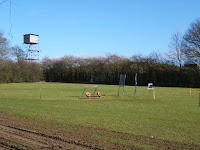

Wednesday 4 February 2009

Alternative Kent Tops - Part Two

The London Boroughs

Westerham Heights (Bromley and Greater London) 804ft

In 1965 , the boroughs of Bexley and Bromley were formed out of the northern part of Kent. Bromley is the largest London Borough in area and is surprising rural and rather hilly. Westerham Heights became the highest point in Greater London after a boundary change in 1993 and thus is actually a county top. (Greater London is a ceremonial county with a Lord Lieutenant etc..). I set off before dawn and timed my journey to arrive at the top of the hill in time for sunrise and I missed it by about a minute. The top was an unmarked spot in a field. This is one county top you could do by bus as the 246 to Westerham goes right by.

I drove on to High Elms Country Park (free car park and no height barrier- thank you Bromley) for breakfast before having a brisk morning walk through the woods and gardens. This part of Bromley is very rural and I drove down some very narrow lanes past Downe House, the home of Charles Darwin which has recently been restored by English Heritage.


Langdon Shaw, Sidcup (Bexley) 272ft

It was a fairly short drive from Orpington to Sidcup, for the very unremarkable top of Bexley. According to my GPS the top is the garden near the white van. I did a circuit of Langdon Shaw and there was actually quite a good view south towards Shooters Hill, but there's much else you can really say about this one. (It can be a very silly hobby at times).


Last stop before returning home for lunch, was Hall Place, which was closed for refurbishment. I wandered around the gardens for a bit, but sadly the A2 runs alongside so it was a bit noisy.

Tuesday 3 February 2009

Alternative Kent Tops - Medway

Holly Hill, 558ft

Medway is that little bit of Kent at the mouth of the river Medway, including the historic towns of Chatham and Rochester. The highest point is Holly Hill, on the North Downs. It's an unmarked spot in a field and isn't even at the top of the hill, which is across the border in Kent.


As Holly Hill is about 30 miles from home, I decided to go topping on a Sunday morning and be home in time for lunch. It should have been a short jaunt from the car park but guess what! another height barrier! So it was going to be a much longer jaunt through the woods from a layby. I set off well before dawn to get through the Dartford tunnel before 6am to avoid the tolls. However that meant I had to spend a hour in total darkness in a layby miles from anywhere. I spent most of the time thinking how to explain what I was doing if apprehended by the forces of law and order as I had in my possession, 3 maps, 2 GPS receivers, mobile phone, camera and binoculars, the complete stalking kit. It was actually quite pleasant setting off in the murky dawn, listening to the dawn chorus, plodding uphill through the woods. Armed with my new GPS I wandered around a large field attempting to find the highest point. Luckily this trespass was obscured from anyone by the misty weather.


I spent some time afterwards having a look around Rochester, which has a castle, cathedral and a strong association with Dickens.

Sunday 1 February 2009

The Kentish Marilyns

Kent has two Marilyns, Detling Hill on the North Downs near Maidstone and Cheriton Hill, the most easterly Marilyn, just outside Folkstone. Once again I visited these in the dead of winter a few years ago accompanied by Noddy.

Detling Hill, 656ft

Anyone travelling to Maidstone on the A249 can bag this hill by visiting White Horse Wood Country Park unless you happen to own an overheight vehicle! (What is it with Kent and height barriers?) Noddy and I took the scenic route along the North Downs Way from the car park at Cobham Manor. It was a very pleasant walk via the village of Thurnham and the ruins of the local castle. There were panaramic views of the Weald of Kent from a newly built viewpoint but that wasn't the top of the hill, which probably lay within the grounds of a bus collector.


Cheriton Hill, 617ft


Cheriton Hill will be familiar to anyone who has travelled on Le Shuttle to France. It's the large hill with very sheer side that looms over Eurotunnel. Wisely I decided to walk up the less steep side from my campsite in Densole. The top itself could have been anywhere on a plateau, but you did get some good views of Folkestone and the sea. I was actually quite lucky with weather too. The return journey took me through Hawkinge, a famous WW2 fighter station.